Pico de la Zarza, Fuerteventura (#2)
Two days after my walk/run up Pico de la Zarza, the achilles tendon was slowly getting manageable again and I was pondering another run or hike. For a while, I was telling myself that I was too tired for a big effort; but then decided to just go for it anyway.
While packing my running backpack, I decided to go lighter this time. On the first ascent I’d worn shorts and a shirt and carried both a merino wool long-sleeve top and a rain jacket / wind breaker, but for this second attempt I’d chosen to forgo those extra layers.
On the highway to Morro Jable, I could see that the mountain peaks were shrouded in clouds, some of which seemed to threaten rain. Alas, I thought it was too late in the day to drive back to the hotel and get more clothes, so I decided to just wing it – I had plastic bags for my cell phone, camera and valuables and a little rain wouldn’t hurt me.
I parked the car at the same spot and set off on exactly the same route as two days before. The first two thirds of the ascent were still under blue skies and sunshine, but I was heading into grey clouds. The wind was even stronger than two days prior. At the beach in Costa Calma, wind speeds of up to 35km/h had been predicted for the day, but I’m sure the numbers on the unprotected mountain slopes were higher.
As such, moving up and into a strong headwind was hard work; but nevertheless I was pushing harder and moving faster than on the first ascent. I managed to climb about 400m of elevation in the first half hour, and after one hour I had gone up almost 800m. Again, not a bad number considering my vertical kilometer ambitions later this year.
I was running the level stuff and the descents (of which there weren’t many) and power walking (or merely walking, depending on how strong of an adversary the wind was at that moment) all of the inclines. At times, I was walking in a crouched over position to offer less of an obstacle to the wind. According to real-time data on my watch, I was moving at a speed of around 8:00 per km at first, and then slowing down to about 9:00 per km towards the end.
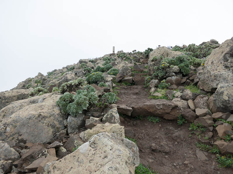
After an hour and close to 800m of cumulative ascent I was on the final switchbacks, and the weather had become really unpleasant. The sun was now hidden by clouds, and the wind felt like a full-on storm. I was only wearing running tights and a flimsy sleeveless top, so pretty much the only thing that provided warmth was my running backpack; and the fact that by moving at a high level of effort my body was producing quite a lot of heat.

Clearly, this wasn’t the time or place to sit down for an extended rest, or to slip and injure myself. However, I was feeling pretty safe in the knowledge that I was less than an hour from civilization, and in the unlikely event of an accident I was in an area with full cell phone reception. If really needed a rescue 4×4 could probably make it most of the way up.
But still, even though I was feeling quite safe and the risk level was not very high in the grand scheme of things (compared to some climb in the Alps, for example), I still felt like I was operating on a fairly thin margin during the final ten minutes of the climb. My hands were starting to feel a little numb from the cold wind and of course I was aware that if the clouds held rain or produced lightning, that I would be fairly exposed.
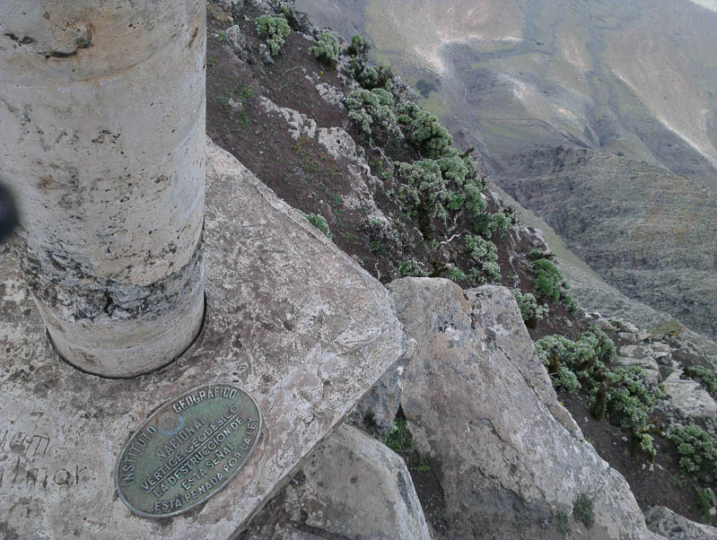
I reached the top in around 1 hour and 10 minutes, 4 minutes faster than two days prior even if the headwind made things harder. I was quite happy with that; and after a few quick pictures and a few seconds of video I turned around and started back down.
Once more, I was running most of the descent. The headwind had now mostly become a tailwind; and since I still didn’t want to sprint down the mountain and ruin both my achilles tendon and my quads, I now had to brake both against the descent and the tailwind. I managed to reach a speed of under 6 minutes per kilometer at least once, even though I stopped a few times to turn around to look at the storm clouds that were now engulfing the mountain top.
The clouds now covered about half of the entire descent, and for a while I felt like I was being chased by them. Fortunately, the closer I got to the beach, the more hospitable the weather became. Still, with one exception I hadn’t seen anyone else head up while I was on the mountain; and I’m sure there was a reason for that.
By the time I reached the car, in a little over 2 hours round trip time including the few photo stops, I felt quite elated; almost as if I had gotten away with something. I guess this kind of thrill is what alpinists go looking for in their mountain climbs; and certainly produced more lasting memories than spending a couple of hours at the pool or beach.
Unfortunately, back at the hotel either my Garmin 910XT or Garmin Express refused to cooperate and despite multiple rescue attempts the activity on my watch vanished before it was successfully transferred to the computer (or the internet). I’m less than thrilled with Garmin, because it’s not the first time this has happened to me, and according to internet forums it has been happening to other people all the way back to 2012.
So, no exact numbers, no GPS tracks to post, no Strava segment times. I’ll survive, 10 years ago nobody even thought of having any of this data or social sharing aspects of running; but it would still be nice to have these things.
1 thought on “Pico de la Zarza, Fuerteventura (#2)”