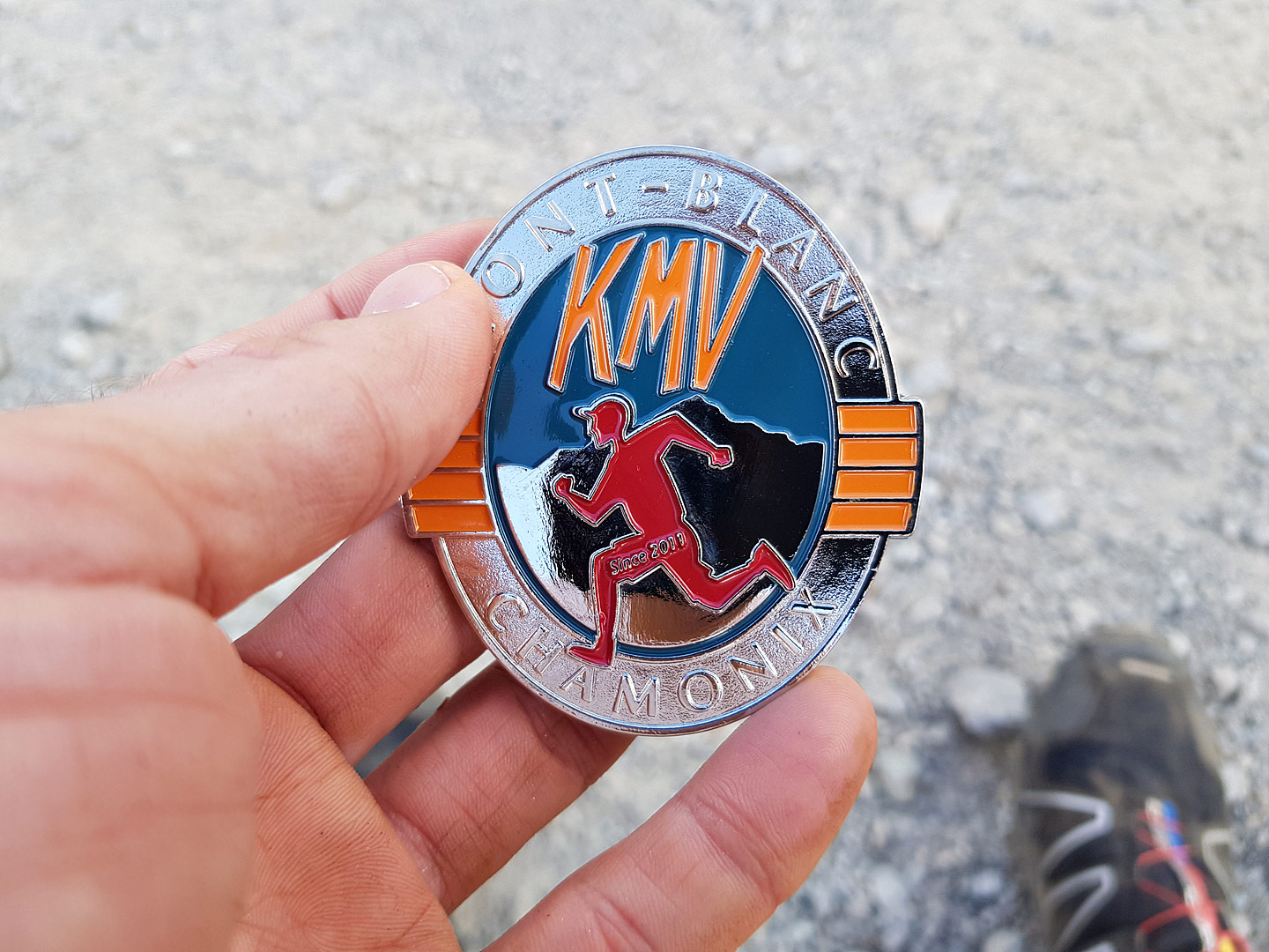
Third time’s the charm? Could the proverb be true, and was I sure to succeed at a task or event on the third try? After 2015 and 2016, I lined up at the Mont-Blanc Vertical KM in Chamonix again in 2017, intent on improving my ascent time for this race that goes up 1000m of elevation over just 3.5km of distance.
KMV
Race report: KM Vertical du Mont-Blanc
KMV, Race report, RunningIf you’ve done something once and then set out to do it again, the expectation is that you’ll do better. Otherwise, why bother, right?
For the second year in a row, I was in Chamonix, France for the “KM Vertical du Mont-Blanc”, a vertical kilometer race that ascends 1000m of elevation in around 3.8km. The previous year, I’d reached my beginners’ goal of finishing in less than one hour. This year, I wanted to do better. But then several track&field events took away my focus and I ended up doing less than half the vertical mileage I’d done the previous year.
The week of the race, the weather predictions were dire. Lows of 10 degrees, highs of 20 degrees, risk of rain showers. I wasn’t all that happy, but I’d cope. But then as Friday came closer, the weather forecast changed. I drove 630km to Chamonix on Thursday, with my car reporting temperatures of up to 36°C. On Friday at 2pm, the temperatures in Chamonix topped out at almost 29°C. I walked 3km to the starting line in that heat, kept my warm-up quite light, and hoped for the best.
With 800 spots available for the vertical kilometer race (up from in 2015), I was expecting there to be lots of stress at the starting line. The opposite was true, with the speakers almost begging people to line up at the time they were supposed to start. Did people just try to wait for cooler temperatures, or had many of them not started at all?
There was no line whatsoever as I crossed the start line and waited for the next 20-second count-down. I couldn’t get my heart rate down below 130 just standing there. I was wearing short running tights, a sleeve-less running top and well-broken-in Brooks Cascadias. In my pocket was a 0.5 liter bottle of water; and I’d emptied another one just like it during warm-up.
The count-down hit zero, and I was off. Strangely enough, my bib (with timing chip) wasn’t scanned at the start, but maybe half a kilometer into the race. The spot where they did the scan was where the route rejoined rue La Mollard – the initial few hundred meters had been changed compared to last year’s course and instead of going straight from Place du Triangle de l’Amitié to Rue La Mollard via a roundabout, the new route bypassed the church on the right, going up several sets of stairs instead.
At the top of Rue La Mollard, a straight and even climb still on pavement, I passed my first competitor. Shortly later, my watch beeped with the encouraging news that I’d covered the first kilometer in a time that was slightly faster than last year. So far, so good. And then, just as I hit the 100m elevation marker, which is also the start of the continuous switchbacks that define the next 400m of elevation gain, things started unraveling.
For some reason, the effort felt harder than it should. I was feeling quite weak, my breathing was labored and I was sweating up a storm. I took a sip of water, but it felt burning hot. I was walking by this point, and I could feel that I wasn’t as strong as I was last year. Whereas last year, I was pushing aggressively, this year even just going through the motions felt like a lot of work.
By the time I reached the 200m elevation marker, the one competitor I’d caught had passed me again. As did several others. I was feeling worse and worse. At some point, I thought that maybe some more water would do me good, and I downed almost the rest of the bottle, but to no positive effect.
300m of elevation. 400m of elevation. 500m of elevation. It’s all a blur, and I catch up with no-one while an increasing amount (10? 15?) people catch me. A random hiker who’s not even in the race is easily keeping up with me even though he’s talking on the cell phone. A little later I let him pass, and he offers me an energy gel. Do I look that bad? I thank him, but refuse. It’d be against the rules, and I don’t feel that the issue I’m having is something that a handful of calories would solve.
Beyond 500m, the single-trail stops being just boring switch-backs and instead gets more technical. There’s a few spots where I use the hands to stabilize myself, not so much because it’s required but rather because I don’t fully trust myself. At least I seem to have stabilized a little and for a while I don’t get passed. I even manage to catch up with two female runners. Little victories do count when you’re down.
600m. 700m. The technical difficulties keep increasing. My heart rate has gone down quite a lot; which means that I’m definitely no longer pushing as hard as I should. But the effort level still seems very hard.
My pace slows down some more as I realize that even though my heart rate is nowhere near its peak, I still feel bad. The slackening of pace is then more for self-preservation; because I don’t want to push beyond the 100% that are possible today; because a missed foot step or a slip could very well a fall of several meters and a fairly bad injury.
Finally, we reach the photo spot that marks the end of the technical scrambling, and I’m sure I was looking very photogenic (or maybe not). When I say “we”, that is actually a good thing because while I’m still getting passed every now and then I’ve finally caught up to a runner or two.
The course changes again it seems (or maybe my memory is hazy by this point) and we seem to go the other way around the cable car station. Now, it’s just an uphill sprint to the finish line, right? I actually start running again, pass another runner, but then as I approach the spot of last year’s finish, there’s… nothing yet. The new course still goes around a bend, and only then does the finish line come in sight.
My breathing is really labored by now; that final running segment has taken all of the remaining energy that I had. As I cross the finish line, the speaker announces me by name and says I’m from “The Netherlands”. Really?
Across the line, there’s a tent and a bench, and I sit down feeling like I weigh two hundred kilograms. I grab a cup of Coke, then another one, then a third one. The guy behind the counter asks me if I’m OK, because apparently I look quite white in my face. I reply to the affirmative, grab two slices of cake and head outside.
I take off the soaking wet running top, take a few photos of the scenery and finish line and text my wife. I was around ten minutes slower than last year (Official time: 1:07:17, versus 0;57:43 last year). I’m quite disappointed, but then again, I had most of the race to come to grips with the realization that today wouldn’t be a good day.
Maybe I need to come back next year?
Race report: Mont-Blanc Vertical Kilometer in Chamonix
KMV, Race report, RunningIn a vertical kilometer race, or kilomètre vertical (KMV) as it’s sometimes referred to in France, the goal is to ascend 1000m of elevation by running (or walking) the shortest possible route on roads or trails. For the Mont-Blanc Vertical Kilometer, the route starts at the Place de l’église just outside the city center at 1000m of elevation and ends at Plan Praz, a gondola lift station at 2000m elevation in the shadow of the Brévent mountain.
On June 26th 2015, I was about to enter this race for the first time. I was a relative newcomer to the mountain running scene, having just run two other mountain climbs in Germany and Austria in the preceding months. Both had been learning experiences, and enabled me to see where my limits were.
Two days before, I had done a reconnaissance hike of the entire race course. (This is where I took almost all of the pictures used in this race report.) Getting a good look at the course and trail conditions in advance didn’t just mentally prepare me for what was ahead, but also allowed me to fine-tune my clothing and hydration choices, especially since the weather was forecast to be the same.
Rather than following the traditional form of a group start (which would get very crowded on the narrow trails higher up the mountain), the Mont-Blanc Vertical Kilometer is run as a time trial; with athletes starting every thirty seconds over the course of several hours. The way this is handled is that the slowest athletes start at 16:00, and depending on your projected finish time you gave them when signing up you’re then put into a time slot (17:30 in my case) around which you can show up at the starting line. You don’t necessarily need to be on time ‘like a Swiss clock‘ – there’s no exact sequence that is strictly enforced, since you’re scanned individually as you set off and that’s when your personal timing starts.
In my case, I set off at 17:19, a few spots behind Charley and Sophie, whose blogs I had found while researching the race and who I had been following on social media. As such, I knew that Sophie was aiming for a finish under 1 hour; which was also my goal. With no other points of reference, these guys (who didn’t know me) would in a way be my implicit pacers, and I knew that if I lost ground to them my pacing wasn’t working.
The city center was quite crowded, and as such everyone sets off to constant applause and encouragements. It’s a little intimidating, and you tend to maybe go off a little faster than you’d planned. I ran past the church, through a traffic circle (traffic police was stopping the cars whenever a runner approached), and then up Rue de la Mollard, a paved road that has an approximate 14% grade.
While I’d done a lot of training for this race, a badly inflamed achilles tendon had put a damper on the amount of cardio I’d been able to do in the months leading up to the race. As such, I had to be very mindful of my heart rate, and knew that I would speed hike a majority of the course rather than being able to run most of it. I was still dismayed to find that I’d reached my limit in the middle of Rue de la Mollard already.
After about 0.5km on the road I then contoured around the Brévent cable car station, and after just a short stretch of wide gravel I reached the start of the switchbacks. Since I was one of the first people to switch from running to power hiking, I’d already lost a position or two.
After about 700m of distance we reached the start of the switchbacks we’d be on for the next half hour or so. It’s all single trail, which makes it quite a lot harder to pass people (or be passed). Soon, we reached 100m of elevation. Only 900 left!
On the switchbacks, I was able to cover ground comparatively well. My speed hiking pace enabled me to keep up with most of the people around me, regardless of whether they were running or hiking, and I even managed to pass a few. Most people were courteous in letting faster athletes pass, and likewise I stopped a few times in the curves of the switchbacks to let someone faster pass me. One person did not move over to let me pass as expected, and a sudden evasive step into grass that I chose to make almost caused me to fall and my heart rate spiked. No other damage done, so I soldiered on. My heart rate at this point was around 177, peaking to 180; which is also very close to my maximum heart rate.
Not much changes as I passed the 200m, 300m and 400m markers. While there were still a few position changes, things had settled down somewhat. Mostly, I tried to inch closer to the person in front of you, while in turn peeking back each time I changed direction on the switchbacks to see if I was opening up a gap towards the people following.
Somewhere around the 500m marker, we reached the sign announcing that the trail was no longer maintained beyond this point. Mostly, this meant that there were occasional small boulder fields to cross, and that the footing was more treacherous in some spots with either loose stones or loose dirt.
Somewhere after the 600m marker, we left the switchbacks behind. Whereas the trail had been going up below the cable car line, we were now starting on a line that veered off to the right and contoured around the mountain slope.
And then the 700m marker came, and it was time to get the hands dirty. In some spots, the trail seemed to go up almost vertically between jagged boulders. There was a cable to hold on to, and I used whatever strength I could muster in my upper body to assist my legs by pulling myself up on the cable.
There were a few spots where a slip or fall would have been painful, but it was always manageable. While the field had thinned considerably by this point, I caught up with a few more people on this stretch. I suppose this is where weaknesses in your strength or endurance will catch up with you.
After the 800m marker, one can finally see the cable car station. Unfortunately, there’s still quite a bit of ground to cover on difficult terrain. This is the rockiest part of the course; and an iron rope was no longer sufficient. The boulders one needs to climb up are quite big. As such, there was an assortment of ladders or iron foot holds, with a guard rail to hold on to. This part of the race culminates in a spot where runners climb up with a sheer rock face on their right and a slippery gravel slope to their left. Here, race photographers set up shop because you can get a nice shot of runners with Chamonix in the valley below as a backdrop.
Beyond the photographers, the trail mellows out a little. With most of the climb facing into the Brévent massif with my back to Mont-Blanc, I was happy to find that for a short while the trail actually opened up with splendid vistas of mountain peaks and glaciers across the valley.
I passed the 900m elevation sign and another official photographer, and then the cable car station was almost within reach. The climb is less dramatic here, but of course with the accumulated fatigue I still didn’t manage much of a run.
After the relative quiet of the climb, the cable car station was much busier with spectators. The path leads over some wooden planks and then up some iron stairs. This of course marks the end of the single trail, and the remaining distance is on a wide dirt road. On its own, the remaining elevation change would not be drastic, but after climbing for close to an hour near my maximum heart rate, it was really hard to convince my legs, lungs and heart to allow me to run over the finish line. I managed, barely.
And just like that, the race was over. Almost straight away, I could see my official finish time on a timing screen, and had the confirmation that I’d stayed under one hour. I loitered around the finish area for a bit, taking photos and sending a text message to the wife saying that I’d survived.
After just a few short minutes, I was feeling quite well again (maybe I had energy reserves I could have tapped into during the race?). I set off to hike/run up to the Brévent, but then after the first bend reconsidered because after all it wasn’t just a jog up the hill but could easily have added an hour or two and maybe caused me to miss the last gondola down if something unexpected happened. Instead, I returned to the finish line to see the fastest athletes arriving. It was a bit disappointing to realize that there wasn’t more of a crowd – their finish times certainly warranted more attention.
After the final athlete arrived, everyone seemed to be in a mad rush to get down the mountain. I decided that with nothing else to do that evening, that I’d attend the victory ceremony (which was held on the main square near the starting line) as well. There was a lottery for all participants, and as luck would have I won a fairly nice supply of Isostar running nutrition (gels, powder, etc.). Afterwards, I set off towards the gym where the pasta dinner was held. This was a no-brainer since (a) it was on the way to the hotel, (b) it was included in the price and (c) I hadn’t eaten dinner yet.
The pasta was good, but of course it was no fun eating in solitude. I guess when elite runners always talk about the camaraderie among athletes, they may be right about it from their point of view; but as a random guy among other random people, a lot of them in established groups, it was hard to make contact with anyone. I didn’t particularly mind though, and instead soon headed out; walked the remainder of the way to my hotel and settled in for a good night’s rest.
Here’s my Strava activity for the race.
Gear that I used:
- Brooks Cascadia 8 shoes (These have been my go-to shoes for most of my trail running in 2014 and 2015, so it was logical to wear something that I knew would work. )
- Ronhill Men’s Trail Cargo Contour Shorts (The differentiating factor between these Ronhill’s and comparable running tights is that they offer plenty of pockets so I could safely stash my cell phone, some paper tissues, my ID and hotel keys in separate locations. Otherwise, I’d always be afraid to, for example, lose one thing if I grabbed another.)
- Under Armour Sonic Compression Men’s T-Shirt (Not much to say. A lot of similar running shirts would have worked just as well).
- Ultimate Performance Handheld Bottle with hand strap (It is debatable whether much water is needed on a <1 hour run. However, I emptied the 0.6 litre bottle on the way up; and when the sketchier parts came I was able to use the strap to fix the bottle on my upper arm and thus have both hands free for climbing/scrambling.)
Update on Vertical Training
KMV, RunningI was going to call this “update on KMV training”, but in my scheduled and tentative races for this year only one out of a potential four events is a true “KMV”, meaning a climb of 1km vertical distance over as short of a distance as possible. But no matter the exact specifics, all my race plans for 2015 so far revolve around covering significant amounts of elevation in comparatively short distances. And finding good training opportunities for that in Luxembourg is challenging.
Around home or work, the biggest climbs I can find still only cover less than 100m of vertical, and none of that is steep or long enough to be really useful. No sense being able to power up a staircase in under a minute and then falling apart a few minutes into a one hour race. So late last year I went nuts on topographic maps and Strava “Segment Explore” and tried to find steeper terrain that was still within an hour’s drive.
There weren’t that many options to start with, but I settled on two different areas as my training grounds: the trails around the “Saarschleife” in neighboring Germany, and a steep single-trail that goes up to “Gringlee” in Northern Luxembourg. The latter is also used as a starting platform for paragliding.
With an average grade of 30%, the Gringlee single trail climbs around 225m of elevation in less than 800m of distance. This is as steep, or maybe even steeper, than what I will encounter at the Chamonix KMV in late June. So far, I have made five visits and “ran” up a total of 17 times. I started in March with an ascent time of 11:51, and as of yesterday have managed to shave off a little over a minute, for the current best of 10:42. According to Strava, this translates to a pace of 13:57 minutes per kilometer; which to any outsider will seem horribly slow. And it gets worse: on subsequent repeats the same day I often drop down to an even slower pace. Part of that is explained by the extreme steepness and the accumulation of effort; but mostly my heart rate quickly goes up and stays way up, so I’m not actually running most of the climb but rather just hiking as fast as the body allows.
Of course the thing with running vs. walking a steep hill is that it’s actually faster to power hike than to run at a slow, sustainable speed. And in the end, there’s no style police and there’s no points being awarded for who walked the least on a climb; what counts is who gets to the top first. But I still wish I could run more, and not just at a leisurely pace. Thankfully, this is something that in theory at least I can train for; and it should get easier the more I do it. Unfortunately, pushing yourself that much is hard work both physically and mentally, and that can be even more challenging after a full day of real work (sitting in an office for 8 hours).
And then there’s the Saarschleife and the trail that leads from the river to the Cloef viewpoint. Its average grade of 13% makes it inherently more runnable, but at 1.4km distance it’s also longer and there’s still around 190m of elevation to cover. When I first ran this in late November, it took me 13 minutes and 20 seconds, at an average pace of 9:26/km. By April, I’ve managed to lower that time to 11:39 (for a 8:14/km pace); and I was feeling quite happy with that effort until someone else on Strava quite effortlessly beat my time by one minute. So once more, lots of potential to run this faster still, but I need to put in the hours.
So far this year, in less than four months I’ve covered almost 23km of vertical, both hiking (9k) and running (14k). Last year the total for twelve months was around 31km (14k hiking, 17k running). Clearly, I’ve done some work already; but there’s more to be done. I need to make sure that I get solid hill efforts in every week, ideally two or three times per week. At the same time, there’s still lots of potential for optimal recovery – while I need to be well-rested, there’s quite a bit of cross-training I could be doing to ensure I’m able to run with better form and to withstand the beating of both the climb up and run down.
One thing I can only influence a little is body weight. While I’ve managed to finally make a small impact in April, I’ll never be as light as Kilian Jornet. At his reported 1.71m and 58 kg, it means that with every step I need to lift an extra 23kg (which still doesn’t make me overly heavy at 1.89m). I’ve been trying to watch my calorie intake in April (and not always succeeding), but so far my monthly average is 1.5kg lighter than that of the preceding months. And even though people I mention this to are always quick to dismiss me, I’m sure my body holds at least a couple more kilos of mostly useless fat that I could lose (14% body fat versus 8% body fat).
My first race will be in a week and a half. But that’s a topic for another blog post.
Pico de la Zarza, Fuerteventura (#3)
Hiking, KMV, Running, TrailAs a former competitive sprinter, I find that I still strive on challenges, and attempting to beat the clock.
With my GPS watch troubles on my second ascent of Pico de la Zarza two days prior that prevented not just a comparison to my previous effort but also others; and the knowledge that so far I hadn’t had perfect conditions, it was clear that there was still a challenge to be had before we were heading back to cold and wet Luxembourg.
With my first ascent on Tuesday in about 1h14 and the second ascent on Thursday in approximately 1h11, that left Saturday as the final opportunity to attack the Pico de la Zarza climb segment on Strava. Short of running a race, I suppose Strava is the next best thing to measuring yourself against other people and making sure you’re putting in a real effort. In this specific case, my 1h14 ascent time would have landed me on 6th place on the leaderboard, while my sub-1h11 time would have put me on #4. As of late March 2015 there were a handful people in this 1h10 to 1h15 range, and I figured that ascending faster than 1h10 was possible. This all pales of course to the leader of the board who is a lot faster, and ascended in just over 48 minutes. So really, the challenge for Saturday was “#2 or bust”.
Of course conditions were still not perfect – I set off at 11:24, which was both a little too close to the copious breakfast I’d had and exactly during the warmest phase of the day. I’m to blame for over-indulging on the hotel buffet, and since the wife wanted to check out the beach at the base of the climb and wanted to get going I couldn’t easily wait a few more hours. But at least the high winds from previous days had abated and there were no dark clouds in sight.
As a matter of fact, there were no clouds in the sky at all as I set off; and before I’d even covered the first two kilometers I’d already emptied most of my first bottle of water.
I still managed to be about two minutes faster on the two initial kilometers than during my first attempt four days ago. I tried to run as much as I could, but whenever my heart rate reached 170 to 175 beats I thought I’d be more prudent to power hike. Unfortunately, that meant that I hiked the majority of the steep stuff.
Compared to my two previous attempts, the trail was somewhat busier, and on the way up I passed maybe 10 people. It was a little reassuring that even though I felt that I was moving slow (walking rather than running), I was still moving faster than Joe Average. Of course those “average” people probably had some choice words amongst themselves for the crazy guy moving past them and never even stopping once to “enjoy the view”. To each their own.
After 30 minutes, I’d covered 3.7km; which translates to almost half the distance. Elevation-wise, my watch logged me at about 350m of elevation (or about 380m of gain since the start). Some quick mental calculations confirmed that I should be able to finish under 1h10. I also realized that two days prior, I couldn’t have covered 400m of elevation by this point in time; because I was moving faster today yet hadn’t reached that number. I guess barometric elevation numbers on the 910XT can be off quite a bit when heading into changing weather.
After 45 minutes, I reached the plateau where the rocky track turns into brown earth and a few green shrubs start to show. It is almost level for a bit and then descends a little. I was able to hit a nice 5:30min/km pace for a few minutes, but then of course the final ascent started.
I was feeling quite depleted, and despite wanting to push, my heart rate just wouldn’t let me. For most of the remainder of the climb, I was steadily hovering around 175bpm even when walking. I suppose doing this kind of effort three times in a week was taking its toll.
I finally made it to the top in 1h06:33; fast enough to be #2 on the segment but a humbling 18 minutes behind #1.
There were a few people at the top, including a couple sitting just next to the stone pillar that marks the highpoint. Quite why people always insist to do their food break in the prime spot that other people want to get to (to merely tag, or to capture on photo) even though there’s plenty of space around is something I still haven’t understood.
I turned around and bounded down the trail. And as I write this and deliberately choose the term “bound”, I still have a smile on my face because running down the initial kilometer was quite enjoyable. First of all because the climb was finally over and moving forward suddenly felt so easy; but also because moving fast over uneven terrain produces an exciting adrenaline rush. Too bad a full time job and a history of injuries that I need to manage mean I can’t do too much of said bounding down a mountain.
At one point, I still stopped to smell the flowers, though. Often it’s just a meaningless proverb, but with the absence of wind the smell of the flowers hung in the air, testament of the arrival of spring and the rain fall these slopes had seen lately.
I continued down trail, almost without a break this time around, and hit a few kilometers in 6min/km pace. A far cry from what real ultra runners can do on a downhill, but I’ll take what I can get.
I arrived back at the car about 1h55 after setting off, for a 49 minute descent.
Pico de la Zarza, Fuerteventura (#2)
Hiking, KMV, Running, TrailTwo days after my walk/run up Pico de la Zarza, the achilles tendon was slowly getting manageable again and I was pondering another run or hike. For a while, I was telling myself that I was too tired for a big effort; but then decided to just go for it anyway.
While packing my running backpack, I decided to go lighter this time. On the first ascent I’d worn shorts and a shirt and carried both a merino wool long-sleeve top and a rain jacket / wind breaker, but for this second attempt I’d chosen to forgo those extra layers.
On the highway to Morro Jable, I could see that the mountain peaks were shrouded in clouds, some of which seemed to threaten rain. Alas, I thought it was too late in the day to drive back to the hotel and get more clothes, so I decided to just wing it – I had plastic bags for my cell phone, camera and valuables and a little rain wouldn’t hurt me.
I parked the car at the same spot and set off on exactly the same route as two days before. The first two thirds of the ascent were still under blue skies and sunshine, but I was heading into grey clouds. The wind was even stronger than two days prior. At the beach in Costa Calma, wind speeds of up to 35km/h had been predicted for the day, but I’m sure the numbers on the unprotected mountain slopes were higher.
As such, moving up and into a strong headwind was hard work; but nevertheless I was pushing harder and moving faster than on the first ascent. I managed to climb about 400m of elevation in the first half hour, and after one hour I had gone up almost 800m. Again, not a bad number considering my vertical kilometer ambitions later this year.
I was running the level stuff and the descents (of which there weren’t many) and power walking (or merely walking, depending on how strong of an adversary the wind was at that moment) all of the inclines. At times, I was walking in a crouched over position to offer less of an obstacle to the wind. According to real-time data on my watch, I was moving at a speed of around 8:00 per km at first, and then slowing down to about 9:00 per km towards the end.
After an hour and close to 800m of cumulative ascent I was on the final switchbacks, and the weather had become really unpleasant. The sun was now hidden by clouds, and the wind felt like a full-on storm. I was only wearing running tights and a flimsy sleeveless top, so pretty much the only thing that provided warmth was my running backpack; and the fact that by moving at a high level of effort my body was producing quite a lot of heat.
Clearly, this wasn’t the time or place to sit down for an extended rest, or to slip and injure myself. However, I was feeling pretty safe in the knowledge that I was less than an hour from civilization, and in the unlikely event of an accident I was in an area with full cell phone reception. If really needed a rescue 4×4 could probably make it most of the way up.
But still, even though I was feeling quite safe and the risk level was not very high in the grand scheme of things (compared to some climb in the Alps, for example), I still felt like I was operating on a fairly thin margin during the final ten minutes of the climb. My hands were starting to feel a little numb from the cold wind and of course I was aware that if the clouds held rain or produced lightning, that I would be fairly exposed.
I reached the top in around 1 hour and 10 minutes, 4 minutes faster than two days prior even if the headwind made things harder. I was quite happy with that; and after a few quick pictures and a few seconds of video I turned around and started back down.
Once more, I was running most of the descent. The headwind had now mostly become a tailwind; and since I still didn’t want to sprint down the mountain and ruin both my achilles tendon and my quads, I now had to brake both against the descent and the tailwind. I managed to reach a speed of under 6 minutes per kilometer at least once, even though I stopped a few times to turn around to look at the storm clouds that were now engulfing the mountain top.
The clouds now covered about half of the entire descent, and for a while I felt like I was being chased by them. Fortunately, the closer I got to the beach, the more hospitable the weather became. Still, with one exception I hadn’t seen anyone else head up while I was on the mountain; and I’m sure there was a reason for that.
By the time I reached the car, in a little over 2 hours round trip time including the few photo stops, I felt quite elated; almost as if I had gotten away with something. I guess this kind of thrill is what alpinists go looking for in their mountain climbs; and certainly produced more lasting memories than spending a couple of hours at the pool or beach.
Unfortunately, back at the hotel either my Garmin 910XT or Garmin Express refused to cooperate and despite multiple rescue attempts the activity on my watch vanished before it was successfully transferred to the computer (or the internet). I’m less than thrilled with Garmin, because it’s not the first time this has happened to me, and according to internet forums it has been happening to other people all the way back to 2012.
So, no exact numbers, no GPS tracks to post, no Strava segment times. I’ll survive, 10 years ago nobody even thought of having any of this data or social sharing aspects of running; but it would still be nice to have these things.
Pico de la Zarza, Fuerteventura
Hiking, KMV, Running, TrailWe’re currently vacationing on Fuerteventura. I set out once more to ascend the island highpoint, Pico de la Zarza (807m) – for the third time on our third stay on the island.
I parked my rental car just off the roundabout on the FV-2 highway. This is the start of the main Strava segment, and also the most logical point to start the hike since on the other side of the road there’s only the beach and not much elevation change. From the roundabout, a side road goes up quite steeply to a large hotel complex. This 200m climb on a sidewalk is shared with tourists returning from the shops or the beach. A runner gets funny looks, because regular tourists at this hotel have probably grown to hate this incline that is between their leisurely day at the beach and eating and drinking themselves silly at the buffet.
On the first intersection I turned left and followed the road past the large hotel. After about 900m, I left paved ground and started following a rocky dirt road on the right. At this point a few cars of hikers or runners that didn’t want to climb the initial 50m of elevation on pavement were parked.
From here on, there would be no more intersections. The road got steeper over the course of the next kilometer on crushed black rocks. 2km into the climb, the first 200m of elevation were behind me. I was already feeling quite thirsty – on the entire climb there’s no shade, and the mid-day sun was beating down.
Next up is a short downhill, during which the entire rest of the trail comes into view. The good news (?) is that it’s all uphill. Unfortunately, there was a strong headwind that made fast forward progress quite hard.
I walked more often than I ran – basically, at this point in time with my fitness being the way it is, I can’t run any strong incline without may heart rate going into unsustainable regions above 170 beats.
Nevertheless, I was making reasonable progress. From km2 to abou km5.5, the trail is mostly a rough Jeep track. At that point, the road levels from a while and there starts to be some plant life. The ground is softer as well, and I could see a few muddy spots, testament to the rain that we had seen the past two days.
At km6, the final climb starts. At first, there’s still a wide track, which gradually narrows. At the beginning of the narrower switchbacks, I was now 1 hour into the climb. Up to here, I had covered about 680m of elevation (according to the realtime data on my Garmin).
The remainder of the climb turned out to be slower than expected, because the track had become quite muddy. Combined with the irregular rocky steps, this made for more work than I had expected. I made it to the top in 1 hour 14 minutes, pretty much the time I had anticipated.
Since I’d already been there twice, I only spent a little time at the peak and then turned around. From here on out, I was able to run most of the way down. Pain in my achilles and a lack of large-scale downhill running made me wary of powering down the mountain, so my “run” entailed quite a lot of braking for a pace of only around 6-7 minutes per km.
Strava recorded a total segment time (up and down) of 2 hours 8 minutes; 855m of elevation change and 14.8km of total distance.
Given my lack of regular training, the high wind and comparatively warm temperatures, I’m quite happy with the time, even though there’s still a lot of potential for improvement.
In light of my upcoming goal (the KMV in Chamonix), being able to cover slightly less than 700m of elevation in one hour is encouraging; especially since that amount of climbing took place over more than 6km; whereas Chamonix only has half of that for the equivalent vertical. At the same time, I’m more than a little concerned by my achilles troubles and the way the left foot felt the day after this climb.
Preparing for the Chamonix Vertical KM – a lengthy preliminary analysis
KMVIn late 2014, I signed up for the Chamonix Vertical KM. While my left achilles tendon has not been happy lately (this is a subject that would merit a blog post on its own), I need to start thinking about how I want to solidify my training approach for this challenge. As of today, there are 136 days left until June 26th 2015, or roughly four and a half months.
So what do I know about the race? And what exactly do I need to prepare for?
A vertical kilometer (commonly abbreviated to “KMV” in French) is a race that has competitors climb around 1000m of elevation in a fairly short distance. In this case, the distance is about 3.5km.
Some statistics on grade
There is a segment on Strava that is actually quite helpful in showcasing just what to expect: an unrelenting climb with an average grade of 27%. And of course the thing with averages is that if a part of the climb is less than average (KM1 “only” climbs 150m, or 15%) then that entails that the rest is more than average (KM2 and KM3 each climb over 300m of elevation, the last 0.5 KM tops them all and climbs over 200m).
And while 27% average grade in itself is already an impressive number, if you split the entire climb into 100m segments, you’ll find out that near the end (when you’re already exhausted), there’s four 100m segments where you’re hit with grades that exceed 50%.
Of course this is all just based on reading numbers out of a graph, which itself was recorded by a GPS device that may not be entirely accurate. But even if some numbers are off by a few percent and some of the grades are different in reality than the numbers make them look, there is one thing that is clear: the combined length and steepness of this climb is unlike anything I can find in a 500km span around my home in Luxembourg.
Some statistics on time
In 2014, the winner (Kilian Jornet) ran to the top in 34 minutes 18 seconds. Out of 425 finishers, a solid 275 (about two thirds of the field) made it there in less than an hour. On Strava, as of early February there’s 74 people in the segment leaderboard and again about two thirds (48) are faster than one hour.
I somewhat naively set myself a target of 1 hour. I’m not basing this on any empirical findings or first-hand experience with climbs like this, but rather just a gut feeling of what I feel I should be capable of. After all, without an ambitious goal I think it would be easy to not take the challenge as seriously as it deserves.
Fundamental requirements
I’ve never been a fan of long distance training plans that prescribe specific mileage numbers for each day over the next few months without ever taking into account what else goes on in your life and how well you’re coping with the plan – most importantly, I feel that for athletes like me who have rarely been injury-free, it’s very easy to shovel your own grave when blindly adhering to someone’s plan (or even your own) that has been set in advance.
So rather than write down a 135 training sessions for the next 135 days, this is about coming up with fundamental requirements and then over the next few months making sure I do enough activities that cover those requirements.
1 hour of effort with elevated heart rate
Due to the unrelenting climb of the KMV, one of the bigger challenges for me will be to move efficiently and continuously with a high heart rate; without burning out too soon. However, due to the relatively flat shape of my country, there is no way I can find a continuous climb that takes longer than ten or twenty minutes.
Of course rather than one continuous effort I could do hill repeats (run the same hill multiple times), but with the heart rate dropping on the inevitable descent this wouldn’t simulate a constant effort at high heart rate.
When I did my first half-marathon two years ago, I was actually surprised at how long I was able to move relatively fast while maintaining a heart rate that I definitely wouldn’t have held during a training run. Over the next few months, if other factors (achilles tendon, etc.) allow it, I should therefore enter a few 10km (or more) road or trail races.
Withstand 1000m of elevation gain
Another big factor will be the requirement in physical strength that comes with climbing 1000m of elevation at a fast pace. While I’ve repeatedly hiked up more than 1000m in past years, and also done so quite speedily, I’ve never covered that much elevation in less than an hour.
Aurélien Rey filmed his 2013 run and posted it on Youtube. (Coincidentally, his run took him just over 1 hour, ie. right around my goal time.)
The KMV course will cover a lot of elevation change on switchbacks with uneven footing and require a bit of scrambling; which means that not only do I need to be able to push myself up the mountain with every step, but I need to do it in a fairly irregular way; with steps that are uneven, tempo changes on turns, and possibly with surges that might be required to move past other runners in tight spots. There will also be a few iron boards and ladders to climb up; as well as spots where taking one single step may mean lifting yourself up 50cm.
With the KMV being on a variety of non-technical and technical terrain, training will not be as easy as getting on a treadmill set to 27% incline and only stop moving after the elevation counter hits 4 digits.
I have quite a few options to do hill or stair repeats near work or home. Following the theory that the more uneven the stairs the better, I should therefore seek out older parts of the city with steps made out of natural stones rather than newer stairs that are perfectly uniform.
As for hills, the same applies: the more turns and the more uneven footing, the better. Of course even a hill that climbs in a straight line can be challenging, but that’s not what I’ll face in Chamonix.
In the past, I’ve already done a few different stair trainings. On Kosakestee, a natural stone path that is quite uneven and has stairs that climb between 50m and 60m in less than 200m of distance, I’ve done both running and walking repeats. When running, I could only manage up to 4 repeats so far, so what I did was to supplement those 4 runs with 4 additional walks. Of course over the course of the next months I should probably build that up, and get closer to covering 1000m of elevation. Unfortunately, that will rule out trainings during my lunch break; because there’s just no way I’m able to do that much in about one hour of effort. Fortunately, we’re starting to get longer hours of daylight, so as I ramp up the duration over the next weeks and months I’ll hopefully be able to move those trainings to evenings after work.
Supplemental strength and mobility
Of course even if I’m able to improve my heart rate and get my body used to longer vertical efforts, there’s still another factor I can improve: raw strength and mobility. While raw strength may be improved by weight room training (and more specifically by squats, I’m thinking), or by doing any of the above-mentioned stairs and hills with weighted vests or backpacks; there’s also a case to be made for mobility work (allowing the body to use a full range of motion). No use packing on several kilograms of muscles if I can’t climb up a large stone in the most straightforward manner.
In closing…
I’m not a professional athlete. I’m not even a seasoned hobbyist who does a multitude of races every year and logs 50 miles or running every week. I’ve experienced many occasions of being motivated to do something and then be set back by injuries, work requirements or just generally life getting in the way. Maybe by moving more of the thought process to this blog I can improve my track record at reaching my goals; and maybe along the way provide some entertainment or information.