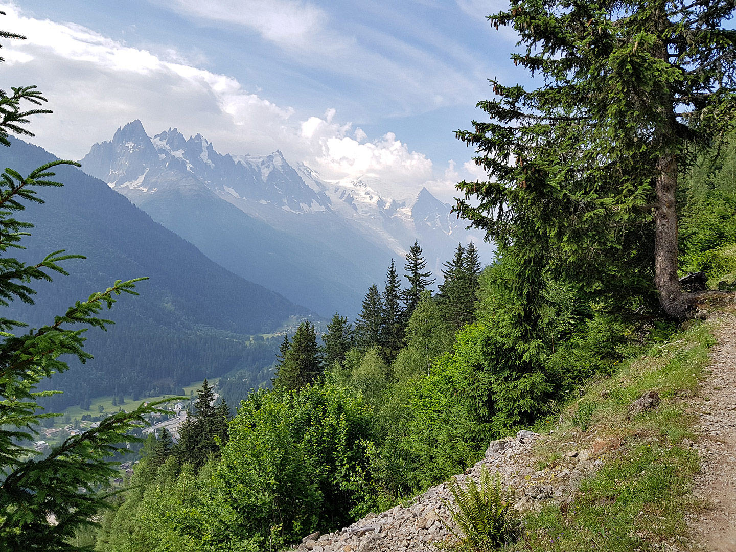
Was it wise to run the 23km du Mont-Blanc race with 1600m of elevation gain less than a day after running the Vertical Kilometer (3.8km with 1000m elevation gain), especially after not doing stellar at the VK? I didn’t know, but once more it was a challenge that would get me out of my comfort zone.
Trail
Race report: Katrinberglauf (4.5km, 943 Hm)
Race report, Trail, VerticalSomewhere along the climb, there was that moment where everything just kind of faded away, and my entire mental focus was reduced to just that next footstep – to get that ideal foot placement, with the most grip and the least amount of slippage. Long gone were the ambitions of finishing in a certain time, long gone were the considerations of who to pass or whether I was about to get passed. Just that next step. And with enough steps, I’d make it across the finish line.
I had arrived in Bad Ischl, Austria the evening before. It had been an unremarkable 720km drive to get there, and I had enough daylight to still take a look at the race course. Of course whenever I’m in the mountains it’s easy to fall prey to the “just around the next corner” fallacy, so I walked quite far, up to the 2km marker for about 360m of elevation. I was sweating buckets even at a leisurely pace, and probably should have turned around sooner.
On race morning, I was able to get an early 7:15am breakfast at my hotel in nearby Bad Goisern and then drove about 8km to the starting line. I was early enough to get a decent parking spot; and proceeded to retrieve my racing bib. There was a small goodies bag included in the 20€ racing fee; which also included a finisher’s t-shirt, transport of a change of clothes to the finish line and the cable car ride down. That’s pretty good value for the money.
I did a quick warm-up on the first few hundred meters of the race course. My achilles tendon was not all that happy, and my heart rate was higher than normal; which was probably because I hadn’t slept well the previous night.
Shortly before 10:00, I joined over 200 runners behind the finish line. I picked a spot that I thought would correspond to my expected finishing time – somewhere half-way to two-thirds away from the fastest starters.
There was a count-down, and we were off. The first 300m past the Katrin-Seilbahn Talstation (cable station) and parking were on the paved Kaltenbachstrasse. The start was much quicker than I’m used to running as of recent (about 4min/km).
After about 300m, the race course turns right at a 90 angle and climbs up past a ski jump training place. The surface changed from paved to gravel as we met our first climb.
My heart rate was already at 170bpm 500m into the race as we turned right at another 90 angle. We were still in the shade, but fairly soon we’d lose that advantage. My run had already transformed into a fast walk. Most of the people around me were still running, but I was matching their speed.
The first kilometer took me 7:52, and only climbed 122m of elevation.
We were now on the grassy ski descent route that we’d follow all the way to the top. Even though the ski slope as a whole was fairly wide, there usually was an established dirt track that was sometimes quite narrow. Obviously in order to optimize your foot placement on dirt or rocks rather than on uneven grass, people had to move in single or double file. Inevitably, this lead to a few position changes and associated speed-ups or slow-downs as I either moved over a meter because my stride length or pace didn’t match the person in front of me, or I was passed for the same reason.
I hit the 2km mark after 19:53, for a 12:00min/km pace on the second km. The elevation gain for this kilometer was 204m. A nice 20% grade, then. At this point I was still hoping for a finish time in the low 50s. However, my heart-rate was becoming problematic. I hit a maximum of 180, and on the second kilometer had an average heart rate of 176.
Starting here, I’d face unknown terrain. And maybe that was a good thing, because things turned steeper at about the same time I started slowing down because I felt my heart rate was not sustainable. I know that I can still move quite efficiently at 170bpm, but 10 beats higher is where I’m shutting down. By this point, positions had been established and for the most part the people in front of me and behind me were moving in single file. Soon after, we came across the first of two water stations. I got a cup of water, but was breathing so hard that actually getting the water down proved to be difficult. I ended up throwing the half-full plastic cup into a waste bag.
Kilometer 3 took me a whopping 15:21. My cumulative time was 35:14. Some very hazy mental math made me conclude there was no way I could finish in either 51 or 53 minutes, as predicted in my race preview, and for the first time I started mentally shutting down a little. I wasn’t exactly thinking of quitting, but it took some mental strength to keep moving forward as well as I could. While the slower pace had brought my heart rate down a little – 174bpm average – the going had become steeper. We’d climbed another 240m of elevation. By now we were moving in full sunlight, and the temperature felt quite high. The prediction was for 24°C at 10:00, but it certainly felt warmer.
And then it got even steeper.
I was still moving in the same single file, and only very occasionally positions changed. Pretty much the only thing I concentrated on was the shoe of the person in front of me, because the spot it had just left would be the spot I’d put my foot on next. Each step then meant a minuscule calculation: where exactly should I set down the foot? Should I rather set it on the dirt or maybe rather use a small exposed stone to maybe get slightly better traction?
Somewhere between 3km and 4km, in the steepest section, I hit my low point. For one step, I was actually thinking of stepping off to the side and resting for a minute or two. But that moment passed, I kept moving. By now, I could already hear the announcer over the speaker system at the finish line. Obviously, the fastest runners had already crossed it a while ago.
There was a second water station at some point, but I decided that since I wasn’t that far away from the finish line it’d be more advantageous to just keep moving. I was starting to feel just a little better, and even managed to catch one or two people who’d passed me near my low point.
The last 400m, there were markers every hundred meters. It was a relief to see them, but even then each individual 100m still took a very long time.
Kilometer 4 took an even slower 18:44. My cumulative time at this point was already 53:58. Thankfully, it seemed that my Garmin had a different mind than the official race distance, because I hit kilometer 4 with about 200m to go; rather than another 0.5km to go.
The fourth kilometer had been the steepest – 297 meters gained, or almost a 30% grade.
And then came the final climb, and then the finish chute where people were encouraged to no longer pass each other; and then finally I crossed the finish line in 55:55.
Result
I crossed the finish line after 55 minutes and 55 seconds. This is over 21 minutes slower than the winner; and puts me at position #146 out of 226 finishers. As such, I barely finished within the top two thirds of the field. My optimistic goal time of 51 minutes would still not have given me a top 100 finish. So should I be happy that 1/3 of the runners finished after me, or be dismayed that I was slower than almost 2/3 of all runners?
Conclusions
Even though I was slower than I had hoped, I cannot really be unhappy with my result. A number of factors come into play, most notably the fact that Luxembourg is not a mountainous country and that our local hills don’t even come close to approximating the strain of what was almost a Vertical Kilometer race.
In the grand scheme of things, most notably with the Chamonix Vertical Kilometer as my “goal” race just two weeks after this race, getting my ass kicked here was a good lesson into just how demanding this type of challenge is and how much work still lies ahead of me. Realistically, there’s very little I can do in these two short weeks to improve my odds to do well on the Chamonix KMV course; but if I kept at this for another year maybe I’d be able to post a better result. But for that to happen, I first need to fix the chronic inflammation in my left achilles tendon – but that’s another topic for another time.
Preview: Katrinberglauf (4.5km, 943 Hm)
Running, Trail, VerticalIn two days, on June 14th, I will be competing at Katrinberglauf. This mountain run in Bad Ischl, Austria, is labelled as “Austria’s steepest mountain race”. The start and finish lines are at the valley and mountain stations of the Katrin Seilbahn cable car, which goes from an elevation of 472m to 1415m, for 943m difference in a distance of about 4.5km. While this does not qualify for the term “vertical kilometer”, it is nearly as close as one can get.
The race was not in my long term plan leading up to the Chamonix KMV in two weeks, but after finishing my first vertical race Wallberg Berglauf on May 1st, I figured I needed another race to be better prepared for what will await me in France. So at the beginning of this week, I took time off from my weekend job as a sports photographer, and decided to do the long drive to Austria and back in order to get more vertical racing experience.
The race will once again be very challenging for someone living and training in a land of hills but that is devoid of mountains. The course description mentions that after the start there will be a short flat section on paved road (250m) and forest path, and then somewhere beyond 500m the relentless climb will start, gaining 943m over the next 4000m of a ski descent route. This would translate to an average grade of just below 24%.
There is a Strava segment that seems to skip the start and last few meters to the finish line; it is 4km long and climbs 917m for an average grade of 23%.
All in all, the grade isn’t too different from my “Gringlee” training hill near Bourscheid; which is around 28% and reduces my run to a walk a lot more than I’d want. I’ve done up to 4 repeats on Gringlee with as little pause as possible. This comes close to approximating the height gain at Katrin but of course I still can’t train for continuous height gain in Luxembourg.
Looking at my segment times on Gringlee, I’m figuring that I should be able to cover the individual kilometers in 11, 12, 13 and 14 minutes respectively; and if I factor in another 3 minutes for the flat 0.5km at the start that would leave me at an estimated finish time of around 53 minutes. To make things slightly more challenging, I set myself a target of 51 minutes on Strava. On the other hand, I haven’t encountered a climb this hard in any of my training, so it’s just as likely that I’ll suffer more and more the higher I go.
In 2014, there were 205 people who crossed the finish line. The winner from Kenia took a mere 33:27 to the top, the first Austrian runner wasn’t too far behind at 35:00. But those are real athletes; which I can’t pretend to be. So if everything goes according to plan, I’m more likely to look at a finish beyond position 100, which last year required a time of 51:06. My realistic estimate of 53:00 would have put me at #122 last year. If things go badly, finishing in 1 hour would have put me at #163.
Of course it’s always difficult to make accurate predictions. I’m not really in the best shape of my life – I’ve had trouble getting enough quality sleep lately and my left achilles tendon has seen better days. On top of that, I’m sure that driving 750km on Saturday will not improve my performance, and most certainly the prospect of driving 750km back home after the race will also play a factor in how deep I can dig during the race.
But at least the weather is forecast to be better than it was for my last race on May 1st; and even though I haven’t been able to train as much for this as I would have liked, I have seen some improvements on routes that I run regularly.
A few days, ago, I wrote this on Facebook:
Realistically speaking I’d need to train at a much higher level for at least another year before being in any shape to truly compete at [..] these races, but this is all about setting myself new challenges and expanding my comfort zone.
Wish me luck.
Race report: Wallberg Berglauf (5.5km 860Hm)
Race report, Running, Trail, VerticalWallberg Berglauf was my first mountain run. I joined 252 other people on a rainy May 1st morning in Rottach-Egern, near Tegernsee lake in Southern Germany to run/walk 5.5km and climb 860m of elevation.
[sgpx gpx=”/wp-content/uploads/gpx/Wallberg Berglauf 5.5km 860Hm.gpx” mtype=TERRAIN summary=TRUE]
Drive to Germany, recon
Having taken the day before the race off work, I left for Germany at a reasonable 9:30am. There was quite a bit of traffic on the A8 for the next handful of hours, but fortunately no traffic jams. There were a lot of construction zones though and a lot of the remaining distance had speed restrictions. I could have gone pedal to the metal a handful of times, but why bother? Most people I saw on the left lane invariably had to step on their brakes a few hundred meters later. I arrived at Tegernsee lake after about six and a half hours (including refueling and three more quick breaks), and was a little surprised to see my old trusty Mondeo was reporting a fuel consumption of 4.4 litres per 100km over the past 560 kilometers.
Since it was still quite early in the day and contrary to weather reports it wasn’t raining yet, I opted to do a little recon. It’s a difficult gamble: how far should I hike up the day before a race? On one hand, it’s useful to see what lies ahead, on the other hand there’s no need to tire yourself out. After running into the race director and his wife at the parking lot (being the first ever person to participate from Luxembourg makes you stand out when you drive up in Luxembourgish plates), I ended up hiking 5.6km (up and down) and 414m of elevation (Strava activity); which may have been a bit too much. To top things off, I had quite a bad headache.
I retreated to my hotel in nearby Bad Wiessee, skipped any dinner plans and was in bed at a record-breaking 18:30.
Race morning
I got up at 6am – definitely can’t say I didn’t get enough sleep. Killed some time on the laptop, showered and was at the breakfast table at 7:45am. Tried to strike a balance between eating enough but not too much, and sampled around 600 calories from the hotel’s breakfast buffet (bread, Nutella, deli meats, small slice of cheese, small yoghurt). A glass of OJ. And of course some coffee.
The weather wasn’t stellar: it had been raining for quite a while when I took the following picture in the morning. Conveniently, my destination for the day was already in plain view (Wallberg mountain center-left and the race finish at the cable station about 100m of elevation further down).
I left my hotel at 8:30, which coincided with the the start of the one-hour window for late registrations and bib pickup. Since I’d signed up in advance, I merely had to pick up my racing number and then had a lot of time to kill before the 10:30 race start. I spent some of it just sitting in the boot under the large rear door of my car (yay for station wagons), pondering what to wear and what to take with me.
With temperatures of around 10 degrees Celsius in the valley and a reported 5 degrees Celsius at the finish line, I had settled on my Asics long tights (non-thermal) over underwear; a form-fitting Kaikialla functional shirt as a base layer on top and a Brooks long-sleeve running shirt over it. I decided against compression socks, but was wearing normal running socks in my well-broken-in Brooks Cascadia 8. I would also don light gloves and a lightweight buff over my head and ears. As more and more people arrived, it was easy to become distracted with clothing options: shouldn’t I rather wear short tights? Or maybe a rain jacket? Salomon shoes looked popular, but I don’t have any of those.
And then, should I take a camera? How about my Gopro? Or maybe skip all electronics except my watch? In the end, I stashed my cell phone in a pocket but left the Gopro in the car. I was sure I’d be plenty busy just moving, never mind about mentally or physically dealing with picture-taking in that stress.
I opted against a long warm-up, instead just walking around a little to stretch my legs occasionally, and then jogging a few hundred meters before walking down about 400m from the parking lot to the starting line.
The race
I lined up at the start line with a reported 280 participants. The race start was delayed for a few minutes (I guess to deal with last-minute late sign-ups). And then we were off. I’d lined up just before the 55min line (the race director’s 10km equivalent time); which was quite conservative but I neither wanted to get out too fast nor did I want to be in a position where I’d be overtaken (read: be in other people’s way) more than necessary.
The first 500m or so were on a paved road; which I guess was a good enough way to get people well spaced.out before the narrower paths start. 2015 was actually the second year this paved part was added to the race, before that people started at the cable station.
On my own, I guess I would have started out faster, but since I was pretty much stuck with the pace those runners around me were setting, I just followed that. I hit the first kilometer in 7:24. The first 500m only had about 30m of elevation gain. The change from lounging around all morning to suddenly being in a race was a bit of a shock to me. My head really wasn’t in it at first. The more things change, the more they stay the same – I’ve had the same to say about quite a few 100m starts back when I was competing on the track. After passing the cable car station on our left, we started climbing for real. I switched over to a fast walk; which still matched the pace of those around me running.

Photo credit: Landkreis Miesbach – Landratsamt Miesbach facebook page
After the initial 500m on road and the next 800m on gravel, the next two kilometers (give or take) would be on mountain trails. These were not quite single-track – there usually was enough space for two people next to each other but since everything was quite muddy and there were lots of exposed rocks or potentially slippery stones, there often was one good single track and then one that was slightly worse next to it.
While the runners had spaced out a little, things were still quite busy. A few times, you’d need to be careful because there were still a few position changes. I found that I didn’t like running or walking just behind someone, since that restricts your visibility of the trail ahead; so instead I often switched over to the slightly more uneven part of the trail that was maybe a little more slippery and closer to the edge on the right; but afforded better visibility of where I’d put my foot the next few steps and a slightly better opportunity to set my own pace.
By the time we hit 2km of distance (and 200m of elevation gain), I was dealing with the onset of a side stitch and just generally not feeling as well as I could; especially seeing how much elevation gain was still in front of me.
We passed Wallbergmoos (a small mountain restaurant) after about 2.25km. After traversing a small meadow, the terrain got steeper again. This was how far I’d gone on the previous day during my recon, so from here on out I didn’t have any mental imagery of the course to rely on.
From km 2.5 to km 3.5, we followed a number of switchbacks. This was the most treacherous terrain yet, but I got through without too many issues. Well, apart from slowing down some more. Here, I also played leapfrog with at least two different runners, who I passed and who passed me again several times. It seems that my pace is indeed quite irregular; and it almost felt like I was able to push a little bit better on the steeper sections, but they ran faster than my fast walking on the less narrow segments. Maybe I annoyed them because they signed up for a mountain run, and here I was walking a lot of it.
After 3.5km, we rejoined a wider path of very small crushed gravel. By here, I’d managed to leave behind one of my co-runners in a yellow jersey; but was once again playing leapfrog with a female runner. For most of the way up, I’d been at a heart rate of 172, so I decided to stay there. But since the climb was less steep here, I was finally able to do some running again. At one point towards the end of this stretch, I even managed to dip below 6min/km pace; but this was short-lived.
At around 4.6km, the route deviates from the wide path for a quick 100m stretch up a meadow. And “up” is the defining factor here, because the grade is around 30%. My heart rate shot up to 175 and there was nothing I could do. Whereas I’d been thinking that I should ramp up my speed and maybe catch some runners – there were a good 10 or 15 that looked within grasp at that point – this spot took the wind out of my sails.
Especially since the remaining distance to the finish line once again felt very steep and I was once again resigned to a fast walk. I could neither catch anyone, nor could I shake off the female runner I’d been exchanging positions with for a while now.
Finally, we neared the top of the race. I was thinking if I should make a move for that one position because everyone else was out of reach now. Just when I had decided to stay behind she slowed down for a second or two, so I went past almost naturally. The last 100 meters or so were on a meadow and because it was flatter I was once more able to run into the arrival chute where our bibs were scanned. I thought I’d put some distance between us, but in the results there’s only 1 second of difference. Oh well.
I stopped my watch just shy of 55 minutes. This was later confirmed when the official results were put up; where I was listed with 54:46.
Bonus climb after the race
After crossing the finish line, I sat down on the ground for a minute. I regained some energy almost straight away, and actually, this happened way quicker than I expected it to; which either means I didn’t give everything on the race or my recent training efforts have made me more resilient.
Either way, I thought since I was already most of the way up to the peak of Wallberg, I might as well run/walk there. To my surprise, none of the runners I had been around joined in; so I made it to the top almost in solitary (I encountered one runner and two hikers climbing down). And half-way up the remaining distance, I understood why the race doesn’t go to the top of the peak: it was quite slippery; and it required more scrambling than some runners might be comfortable with. At one point I even had to do some easy climbing moves, but i guess that was more because of my poor route choice in that spot.
The climb to the top added 12 minutes to the climb and another 137m. Which means I failed to hit 1000m of elevation gain; although just barely.
On the way down, the rocks I’d scrambled up on were very slippery, and I had to be very careful not to fall. Actually, I slipped once, and just barely was able to prevent my rear from making an unplanned contact with the ground. Good thing I was wearing gloves, because my hands made full contact with the muddy trail and rocks to break the fall.
Restaurant meal and raffle
Of course by the time I got back to the official finish, everyone had arrived, and the finish zone was already starting to get torn down. I got something warm to drink, then retreated into the cable car station to change into my warm clothing (which had been sent up by cable car – a welcome service). And of course with everyone across the finish line the restaurant was packed by now. The race fee includes a free meal (Kaiserschmarrn), so I opted to stay and hang around for a bit. I ordered a coffee with the free meal, but was a little surprised to pay 4.20€ for the coffee. This seemed a little steep.
Before the victory ceremony, there was a raffle being held. My bib number ended up winning a pair of socks. It’s just a small thing, of course, but I guess as a runner you can never have too many socks (even if these, being white, are not the best colour for trail runners).
At around 14:00, the race organiser announced that the official results would be put on the walls in the staircase outside the restaurant. I decided to go look – I guess deep down I’m still as competitive than I was as a sprinter, and want to know where my performance puts me. And then suddenly I decided I’d had enough of the crowded restaurant and people in general and opted out of spectating the victory ceremony (which I couldn’t see from my seat in the restaurant, anyway) and took a cable car down before everyone else would do so.
In conclusion
Thumbs up to the race organisers and volunteers. It’s a very nice event and I’m glad I made the drive down from Luxembourg. The weather could have been better, but at least it didn’t snow. I’m happy with my performance to the extent that it was my first participation at an event of this kind. My time puts me at position 136 of 253, which means I’m somewhere past half-point in the results. The time, coincidentally, is near my “reasonable” expected time; but of course much slower than what I feel I should be capable of doing if I keep training for events like these. So in summary, I liked today’s event and am looking forward to returning either here or similar events in the future.
24/Apr/2015 – 9km run urban & trails
TrailToday might be the end of a good weather window that lasted a good two weeks. Certainly not the norm for Luxembourg, so I figured before we’re back to several months of drizzle, I’d be productive in my lunch break and go for a trail run. Wasn’t feeling too good (slightly tired, both overall fatigue and a little remainder muscle soreness from the 920Hm on Tuesday), so I opted for a regular run instead of a hill session.
Ended up covering 8.97km in 1:00:52 with 247m of elevation gain. Felt a tightness in the left achilles, but nothing too bad.
I’m not happy with my overall fitness. Felt like I had to work too hard (152bpm average heartrate) to reach the 6:47 min/km average pace that the Garmin recorded; although I guess I would be faster if stayed on flatter ground.
Only one week to go until my first race of the year, Wallberg Berglauf. Currently, my schedule calls for a 4-hour workday on April 30th, a dentist appointment at 1pm followed by a 600km drive to Southern Germany that I expect to take at least 6 to 7 hours (long weekend means heavy traffic) and then run the 5.5km / 860Hm race on Friday morning (10:30). The wife will not be joining me on this trip, so I have the remainder of Friday, all of Saturday and part of Sunday available for more mountain stuff in the foothills of the Alps before heading back 600km on Sunday afternoon.
Pico de la Zarza, Fuerteventura (#3)
Hiking, KMV, Running, TrailAs a former competitive sprinter, I find that I still strive on challenges, and attempting to beat the clock.
With my GPS watch troubles on my second ascent of Pico de la Zarza two days prior that prevented not just a comparison to my previous effort but also others; and the knowledge that so far I hadn’t had perfect conditions, it was clear that there was still a challenge to be had before we were heading back to cold and wet Luxembourg.
With my first ascent on Tuesday in about 1h14 and the second ascent on Thursday in approximately 1h11, that left Saturday as the final opportunity to attack the Pico de la Zarza climb segment on Strava. Short of running a race, I suppose Strava is the next best thing to measuring yourself against other people and making sure you’re putting in a real effort. In this specific case, my 1h14 ascent time would have landed me on 6th place on the leaderboard, while my sub-1h11 time would have put me on #4. As of late March 2015 there were a handful people in this 1h10 to 1h15 range, and I figured that ascending faster than 1h10 was possible. This all pales of course to the leader of the board who is a lot faster, and ascended in just over 48 minutes. So really, the challenge for Saturday was “#2 or bust”.
Of course conditions were still not perfect – I set off at 11:24, which was both a little too close to the copious breakfast I’d had and exactly during the warmest phase of the day. I’m to blame for over-indulging on the hotel buffet, and since the wife wanted to check out the beach at the base of the climb and wanted to get going I couldn’t easily wait a few more hours. But at least the high winds from previous days had abated and there were no dark clouds in sight.
As a matter of fact, there were no clouds in the sky at all as I set off; and before I’d even covered the first two kilometers I’d already emptied most of my first bottle of water.
I still managed to be about two minutes faster on the two initial kilometers than during my first attempt four days ago. I tried to run as much as I could, but whenever my heart rate reached 170 to 175 beats I thought I’d be more prudent to power hike. Unfortunately, that meant that I hiked the majority of the steep stuff.
Compared to my two previous attempts, the trail was somewhat busier, and on the way up I passed maybe 10 people. It was a little reassuring that even though I felt that I was moving slow (walking rather than running), I was still moving faster than Joe Average. Of course those “average” people probably had some choice words amongst themselves for the crazy guy moving past them and never even stopping once to “enjoy the view”. To each their own.
After 30 minutes, I’d covered 3.7km; which translates to almost half the distance. Elevation-wise, my watch logged me at about 350m of elevation (or about 380m of gain since the start). Some quick mental calculations confirmed that I should be able to finish under 1h10. I also realized that two days prior, I couldn’t have covered 400m of elevation by this point in time; because I was moving faster today yet hadn’t reached that number. I guess barometric elevation numbers on the 910XT can be off quite a bit when heading into changing weather.
After 45 minutes, I reached the plateau where the rocky track turns into brown earth and a few green shrubs start to show. It is almost level for a bit and then descends a little. I was able to hit a nice 5:30min/km pace for a few minutes, but then of course the final ascent started.
I was feeling quite depleted, and despite wanting to push, my heart rate just wouldn’t let me. For most of the remainder of the climb, I was steadily hovering around 175bpm even when walking. I suppose doing this kind of effort three times in a week was taking its toll.
I finally made it to the top in 1h06:33; fast enough to be #2 on the segment but a humbling 18 minutes behind #1.
There were a few people at the top, including a couple sitting just next to the stone pillar that marks the highpoint. Quite why people always insist to do their food break in the prime spot that other people want to get to (to merely tag, or to capture on photo) even though there’s plenty of space around is something I still haven’t understood.
I turned around and bounded down the trail. And as I write this and deliberately choose the term “bound”, I still have a smile on my face because running down the initial kilometer was quite enjoyable. First of all because the climb was finally over and moving forward suddenly felt so easy; but also because moving fast over uneven terrain produces an exciting adrenaline rush. Too bad a full time job and a history of injuries that I need to manage mean I can’t do too much of said bounding down a mountain.
At one point, I still stopped to smell the flowers, though. Often it’s just a meaningless proverb, but with the absence of wind the smell of the flowers hung in the air, testament of the arrival of spring and the rain fall these slopes had seen lately.
I continued down trail, almost without a break this time around, and hit a few kilometers in 6min/km pace. A far cry from what real ultra runners can do on a downhill, but I’ll take what I can get.
I arrived back at the car about 1h55 after setting off, for a 49 minute descent.
Pico de la Zarza, Fuerteventura (#2)
Hiking, KMV, Running, TrailTwo days after my walk/run up Pico de la Zarza, the achilles tendon was slowly getting manageable again and I was pondering another run or hike. For a while, I was telling myself that I was too tired for a big effort; but then decided to just go for it anyway.
While packing my running backpack, I decided to go lighter this time. On the first ascent I’d worn shorts and a shirt and carried both a merino wool long-sleeve top and a rain jacket / wind breaker, but for this second attempt I’d chosen to forgo those extra layers.
On the highway to Morro Jable, I could see that the mountain peaks were shrouded in clouds, some of which seemed to threaten rain. Alas, I thought it was too late in the day to drive back to the hotel and get more clothes, so I decided to just wing it – I had plastic bags for my cell phone, camera and valuables and a little rain wouldn’t hurt me.
I parked the car at the same spot and set off on exactly the same route as two days before. The first two thirds of the ascent were still under blue skies and sunshine, but I was heading into grey clouds. The wind was even stronger than two days prior. At the beach in Costa Calma, wind speeds of up to 35km/h had been predicted for the day, but I’m sure the numbers on the unprotected mountain slopes were higher.
As such, moving up and into a strong headwind was hard work; but nevertheless I was pushing harder and moving faster than on the first ascent. I managed to climb about 400m of elevation in the first half hour, and after one hour I had gone up almost 800m. Again, not a bad number considering my vertical kilometer ambitions later this year.
I was running the level stuff and the descents (of which there weren’t many) and power walking (or merely walking, depending on how strong of an adversary the wind was at that moment) all of the inclines. At times, I was walking in a crouched over position to offer less of an obstacle to the wind. According to real-time data on my watch, I was moving at a speed of around 8:00 per km at first, and then slowing down to about 9:00 per km towards the end.
After an hour and close to 800m of cumulative ascent I was on the final switchbacks, and the weather had become really unpleasant. The sun was now hidden by clouds, and the wind felt like a full-on storm. I was only wearing running tights and a flimsy sleeveless top, so pretty much the only thing that provided warmth was my running backpack; and the fact that by moving at a high level of effort my body was producing quite a lot of heat.
Clearly, this wasn’t the time or place to sit down for an extended rest, or to slip and injure myself. However, I was feeling pretty safe in the knowledge that I was less than an hour from civilization, and in the unlikely event of an accident I was in an area with full cell phone reception. If really needed a rescue 4×4 could probably make it most of the way up.
But still, even though I was feeling quite safe and the risk level was not very high in the grand scheme of things (compared to some climb in the Alps, for example), I still felt like I was operating on a fairly thin margin during the final ten minutes of the climb. My hands were starting to feel a little numb from the cold wind and of course I was aware that if the clouds held rain or produced lightning, that I would be fairly exposed.
I reached the top in around 1 hour and 10 minutes, 4 minutes faster than two days prior even if the headwind made things harder. I was quite happy with that; and after a few quick pictures and a few seconds of video I turned around and started back down.
Once more, I was running most of the descent. The headwind had now mostly become a tailwind; and since I still didn’t want to sprint down the mountain and ruin both my achilles tendon and my quads, I now had to brake both against the descent and the tailwind. I managed to reach a speed of under 6 minutes per kilometer at least once, even though I stopped a few times to turn around to look at the storm clouds that were now engulfing the mountain top.
The clouds now covered about half of the entire descent, and for a while I felt like I was being chased by them. Fortunately, the closer I got to the beach, the more hospitable the weather became. Still, with one exception I hadn’t seen anyone else head up while I was on the mountain; and I’m sure there was a reason for that.
By the time I reached the car, in a little over 2 hours round trip time including the few photo stops, I felt quite elated; almost as if I had gotten away with something. I guess this kind of thrill is what alpinists go looking for in their mountain climbs; and certainly produced more lasting memories than spending a couple of hours at the pool or beach.
Unfortunately, back at the hotel either my Garmin 910XT or Garmin Express refused to cooperate and despite multiple rescue attempts the activity on my watch vanished before it was successfully transferred to the computer (or the internet). I’m less than thrilled with Garmin, because it’s not the first time this has happened to me, and according to internet forums it has been happening to other people all the way back to 2012.
So, no exact numbers, no GPS tracks to post, no Strava segment times. I’ll survive, 10 years ago nobody even thought of having any of this data or social sharing aspects of running; but it would still be nice to have these things.
Pico de la Zarza, Fuerteventura
Hiking, KMV, Running, TrailWe’re currently vacationing on Fuerteventura. I set out once more to ascend the island highpoint, Pico de la Zarza (807m) – for the third time on our third stay on the island.
I parked my rental car just off the roundabout on the FV-2 highway. This is the start of the main Strava segment, and also the most logical point to start the hike since on the other side of the road there’s only the beach and not much elevation change. From the roundabout, a side road goes up quite steeply to a large hotel complex. This 200m climb on a sidewalk is shared with tourists returning from the shops or the beach. A runner gets funny looks, because regular tourists at this hotel have probably grown to hate this incline that is between their leisurely day at the beach and eating and drinking themselves silly at the buffet.
On the first intersection I turned left and followed the road past the large hotel. After about 900m, I left paved ground and started following a rocky dirt road on the right. At this point a few cars of hikers or runners that didn’t want to climb the initial 50m of elevation on pavement were parked.
From here on, there would be no more intersections. The road got steeper over the course of the next kilometer on crushed black rocks. 2km into the climb, the first 200m of elevation were behind me. I was already feeling quite thirsty – on the entire climb there’s no shade, and the mid-day sun was beating down.
Next up is a short downhill, during which the entire rest of the trail comes into view. The good news (?) is that it’s all uphill. Unfortunately, there was a strong headwind that made fast forward progress quite hard.
I walked more often than I ran – basically, at this point in time with my fitness being the way it is, I can’t run any strong incline without may heart rate going into unsustainable regions above 170 beats.
Nevertheless, I was making reasonable progress. From km2 to abou km5.5, the trail is mostly a rough Jeep track. At that point, the road levels from a while and there starts to be some plant life. The ground is softer as well, and I could see a few muddy spots, testament to the rain that we had seen the past two days.
At km6, the final climb starts. At first, there’s still a wide track, which gradually narrows. At the beginning of the narrower switchbacks, I was now 1 hour into the climb. Up to here, I had covered about 680m of elevation (according to the realtime data on my Garmin).
The remainder of the climb turned out to be slower than expected, because the track had become quite muddy. Combined with the irregular rocky steps, this made for more work than I had expected. I made it to the top in 1 hour 14 minutes, pretty much the time I had anticipated.
Since I’d already been there twice, I only spent a little time at the peak and then turned around. From here on out, I was able to run most of the way down. Pain in my achilles and a lack of large-scale downhill running made me wary of powering down the mountain, so my “run” entailed quite a lot of braking for a pace of only around 6-7 minutes per km.
Strava recorded a total segment time (up and down) of 2 hours 8 minutes; 855m of elevation change and 14.8km of total distance.
Given my lack of regular training, the high wind and comparatively warm temperatures, I’m quite happy with the time, even though there’s still a lot of potential for improvement.
In light of my upcoming goal (the KMV in Chamonix), being able to cover slightly less than 700m of elevation in one hour is encouraging; especially since that amount of climbing took place over more than 6km; whereas Chamonix only has half of that for the equivalent vertical. At the same time, I’m more than a little concerned by my achilles troubles and the way the left foot felt the day after this climb.
KMV training: Saarschleife Orscholz
TrailWith my left foot altogether not happy, I should probably be doing low volume for a while. But after three days of rest, I had the itch to do some meaningful training; especially since I received confirmation on Wednesday that I’m now fully signed up for the Mont-Blanc KM Vertical on June 26 2015. While it’d be easy to say “that’s in the middle of next year, plenty of time”, I’m somewhat intimidated by the event and want to prepare it well.
A vertical KM is best described as a race that has you climb one thousand meters of elevation in as small of a distance as possible. In Chamonix, that will be 3.8km. And therein lies the main challenge for someone who lives in Luxembourg, far away from any meaningful mountains: there’s nothing in close proximity that offers 1000m of climbing. If I restrict my search to about 30 minutes of driving, the closest I’ve found in terms of big elevation change is the slopes of the Saarschleife in neighboring Germany.
I’ve mapped a segment on Strava, and the trail that snakes up from the river to the Cloef viewpoint is climbing about 190m in 1.4km of distance, for an average incline of 13%. This is a far cry from what will await me in half a year, but it’s the best I could find so far.
One good way to prepare for the physical stress of a climbing a vertical KM without having an actual mountain in from of you is to do hill repeats. Which is what I set out to do. After parking the car (and paying 1€ for the privilege), I jogged to the viewing platform that overlooks the bend of the river Saar.
The weather was dreary, but not all that cold (6°C) and fortunately it did not rain. I carefully descended down to the river over the same trail I’d take up again just a little bit later. There’s lots of dead leaves on the ground, and they do a nice job of covering lots of small stones and dead tree branches that you can trip over. I figured that the small jog and slow descent would sufficiently warm me up for the first ascent that would follow. After 2.3km and 18 minutes, I was ready to go back up.
At this point in my athletic life, running up a hill makes me reach a heart rate of 170 pretty fast. That wouldn’t be so bad if it weren’t for my max heart rate of about 185. Which means that I’m above 90% effort, which puts a considerable strain on not just the heart but the whole system.
I covered the first climb in 13:45 minutes with an average heart rate of 172; about a minute and a half slower than my current personal best on this segment. But unlike that time, I didn’t go at a max effort, but preserved some energy for what was still to come. On the descent, I was still fairly cautious, but stepped off the proverbial brake for a bit – it’s just more fun to barrel down a descent and take one large leap over some obstacle, rather than take three cautious and slow steps over it. But I can only do that for so long before being reasonable again, and I arrived at the bottom ready to go back up again.
The second climb was still OK at first, but I was starting to get tired already. As such, I walked parts of it, clocking 14:33 with an average heart rate of 170.
The third climb, I started walking quite early, and I was starting to be less focused mentally which means I no longer pushed a hundred percent; which translated to a time of 16:01 and an average heart rate of 161.
Altogether (warm-up, ascents and descents, cool-down) I ran (and power hiked) 10.2km in 1:31:30, for an average pace of 8:57. That sounds quite pedestrian until you factor in the total climb of 652m.If I were to string together the time required for the three climbs and ignore the descents, I would clock about 44:15 for 570 vertical meters and 5.2km of distance. Of course that is ignoring the added strain of continued climbing. Certainly, there’s a lot of potential for improvement, and I feel that I should be able to significantly improve this with a few more months of focused training.
1 November 2014: 11.3km trail run
TrailAs usual, my forays into the Haard natural reserve start with a quick run up the road from our house, and then into the forest. The first 2km already hit you with 100m of elevation.
Next, I decided to deviate from my standard route and head East towards an area that is referred to as “Tipp” on some of my maps. Translated, that means “dump”; which may refer to the area being used for mining maybe a century ago.
What this means that there’s quite a few climbs like this, which look like they’re only ever being used by downhill MTBers.
The following climb was quite hard (even though the image doesn’t really do it justice). Near the top, it took me a few minutes to get stable enough footing – for a while, I was stuck in a fairly sketchy spot I didn’t particularly want to descend back from, but couldn’t move up from because with every step up I was sliding back down again. It didn’t help that everything I tried to grab for support was loose and crumbly.
I finally made it to the top, at which point I reverted back to trails I normally follow.
Summary:
Avg Pace: 8:05 min/km
Time: 1:31:28