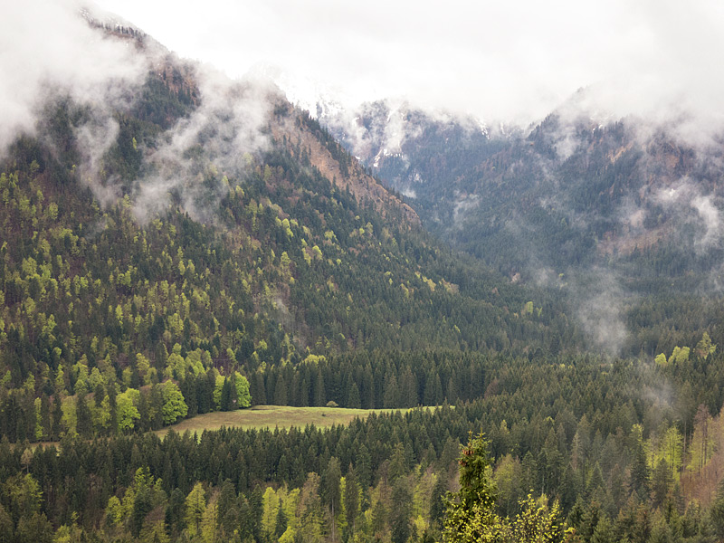
After competing in the Wallberg Berglauf the day before, I had a full day left in the Tegernsee region before my 600km drive back to Luxembourg. And while there were heavy rains all throughout the day, I was determined to not let it go to waste – it would be a shame to be in the mountains (even though it was only the less jagged foothills of the Alps) and not climb something.
[osm_map_v3 map_center=”47.705,11.697″ zoom=”12″ width=”100%” height=”450″ file_list=”../../../../wp-content/uploads/2015/05/Bad-Wiessee-hike.gpx”]
I ended up hiking 33km in total, with some limited running thrown in to increase the pace a little. This was only possible a couple of times, conditions being the grade (the first few kilometers out of Bad Wiessee were quite steep) and whether or not I was holding an umbrella (it was raining that heavily). After covering 20km and starting to get tired, I thought it was more prudent to skip running altogether.
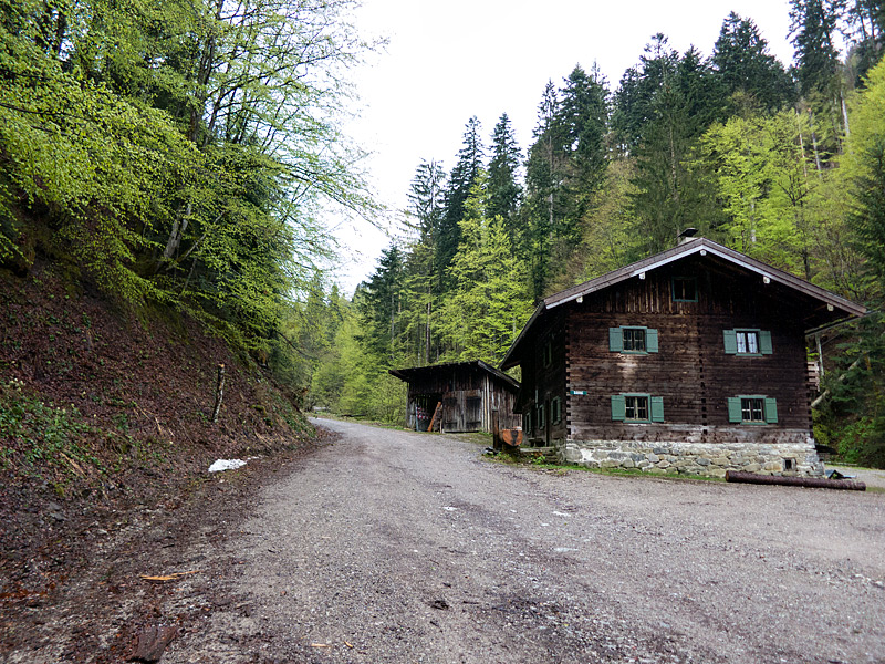
For the first 50 minutes, I followed Breitenbach, a small river, into the forested slopes on the west side of Tegernsee. In the first hour, I covered just over 400m of elevation. Over the next half hour, the trail gradually got less steep and contoured around the hills in a southerly direction towards Aueralm. This part of the climb had been signposted near the trailhead as taking 3.5 hours; and initially it looked like I would match that time. It seems that I made good progress further up.


I didn’t stop at Aueralm, but instead headed on towards the first peak that was signposted. Fockenstein (1564m) was supposed to be one hour away. I made it to the top three quarters of an hour later; but most of that wasn’t pleasant: at first the going was still quite relaxed, but then the winds picked up. For a while I was heading straight into the wind, so the umbrella definitely helped in sheltering me. Further up, I was seeing the effects of recent snowmelt: the grassy path was soaked, any exposed stone was dangerously slippery, and all bare earth had been turned into a mudfest.I was wearing my Brooks Cascadia 8 trail runners, and they don’t do too well in slippery conditions. Furthermore, they’re not water-proof in any way, so my feet got wet in no time. At least the advantage of a shoe that is not water-proof is that due to the foot generating heat, any water that enters has a chance to get out again.


My navigation was limited to the signposts that were present at any trail intersection. I had safely tucked my brand new cell phone into two layers of ziplock bags and wasn’t going to risk having it get wet just to look at a GPS map – I didn’t have any solid destination in mind, anyway.
I hiked down the same way I’d come up for some 25 minutes, and then continued South. There had been signs for “Kampen (1594m)”, so I’d decided I would try this next. On the final ascent however, with some 300m of elevation to go, I had a one-person safety meeting. The trail was getting quite steep and snowed over; and conditions would probably not improve. Therefore, if I had to come down the same way, I’d be looking at a lot of slippery footing. “Not worth it”, I concluded.


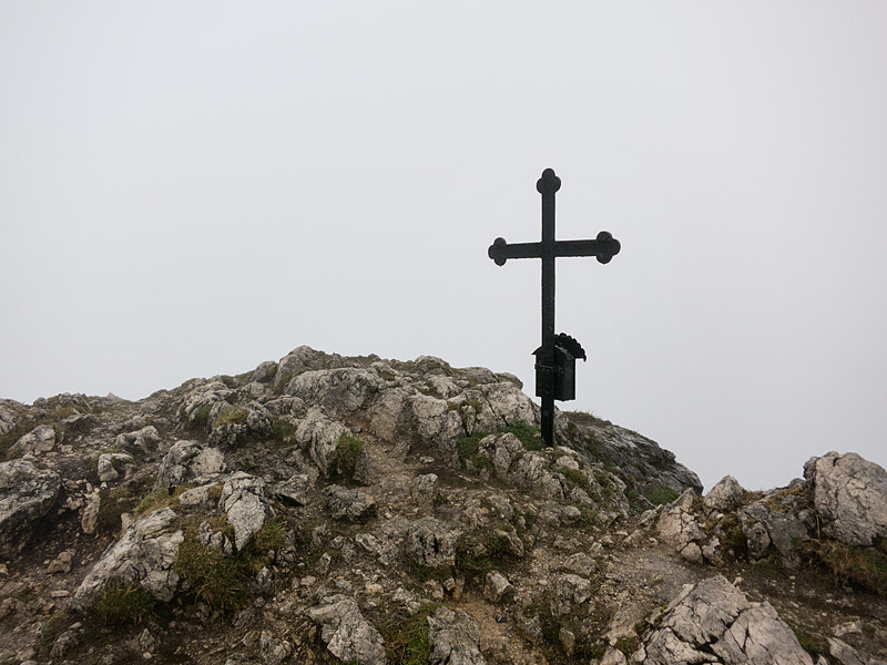
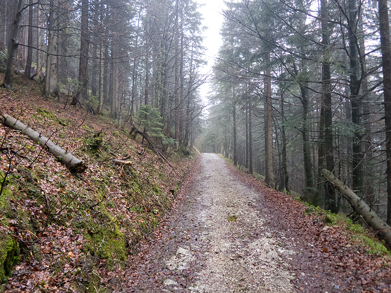
So I headed back down and followed a larger and less steep trail towards “Seekarkreuz”. The going here was quite monotonous – a steady grind that climbed slowly but steadily on a narrow forest / gravel road. But as I increased in elevation, I encountered more and more snow. Also, as the snow was saturated with he falling rain, no matter how careful I was, each contact with it meant my feet got wet. After three successive snow fields and conditions further up looking to worsen, I decided to once again turn around. This was at around 1430m.

With two out of three summit attempts foiled, I decided it was time to head back to the valley. I’d already covered close to 20km of distance by this point. At the next intersection there was a small single trail going down towards Bad Wiessee along “Söllbach”; but I decided against this option; again because of the slippery conditions of the trails. Instead, I backtracked on the wider paths towards Aueralm, by which time I’d done 25km in slightly over 4h40. From here, I had two options: head down the same way I’d come up, or take a different road that looked steeper. I opted for the latter because I thought it would be faster. And it was at first, dropping me down towards Tegernsee quite efficiently.


However, when I exited the forest I found myself south of my hotel, which meant I had to follow the sea shore for a couple of kilometers to get back to my hotel. In the end, I reached it after a total of 33km. The hike down from Aueralm had taken 8km, a saving of a whopping kilometer compared to the 9km ascend.

The final tally for the day was exactly 6 hours on my feet. Since I had done no sitting breaks, my GPS watch had recorded a “moving time” of 5h43. My average pace was 10:55min/km, or 10:24 when only considering the moving time. Elevation-wise, my Garmin 910XT recorded 1399m of total elevation gain.
One Comment Add yours